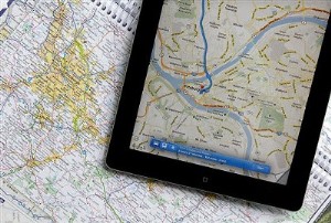
It is amazing how our usage of maps has changed dramatically with the advent of portable electronic maps. The interesting part is that beyond the map itself as a tool, our relationship with our geographical environment is also changing dramatically too.
I am of a generation that used paper maps and atlases to navigate the world, including for driving around. I notice how this mundane task (which was traditionally a highly contentious activity for couples when the significant other was reading the map) has changed.
What I find to be the most startling change of functionality is the possibility to zoom as we want, using maps as an actual multi-scale tool, in addition to knowing at any one time where one is located thanks to the GPS.
Moreover, the amount of data super-imposed on the map has increased tremendously, allow new usage of maps, and they also are increasingly updated more or less real time. We tend more and more to interpret our immediate environment not only with what we can observe, but with the added data available in our pockets, from the location of services and businesses to their rating and more detail about their operation. It is augmented reality in its infancy. And it is only the beginning.
It is amazing how with portable multi-scale, multi-layer maps our perception of the physical world around us is changing. I still hope we will able to keep relying on actual observation of reality!
